Michinoku Coastal Trail Routes & Itineraries
You don't need to walk all 1,000+ km of the Michinoku Coastal Trail to experience what makes it special.
Some of my favourite parts of the entire trail can be walked in a single day or a long weekend. If you have more time, trains and local transport also make it possible to link several great sections together without having to walk every kilometre in between.
I've been walking the MCT since 2017, including a full thruhike, and the routes below are the places I'd personally point people towards depending on how much time they have.

Yokonuma Viewpoint (Kuji-Taneichi, 2-day hike)
Not Sure Where to Start?
If this is your first MCT trip, these would be my quick picks.
Tanesashi Coast
Easy to reach, relatively gentle, and packed with variety. If you only have one day, this is probably where I'd start.
VIEW TANESASHI COAST →Fudai to Tanohata
Huge cliffs, serious ups and downs, Kitayamazaki and the hand-dug tunnels. Harder, but difficult to beat.
VIEW FUDAI TO TANOHATA →Cliffs, Tunnels & the Pure Land
A 3–4 day trip combining Fudai, Kitayamazaki, the tunnels, Taro and Jodogahama.
SEE THE 3–4 DAY ITINERARY ↓Best of Northern Sanriku
A week linking some of the strongest walking between Hachinohe and Jodogahama, using trains and short transfers along the way.
SEE THE 7-DAY ITINERARY ↓Day Hikes


Goishi Coast & Kurosaki Senkyo (1 day)
A compact but beautiful section around Ofunato, with rocky coastline, clear water and the smooth black stones that give Goishi Coast its name.
Continue around the peninsula and you can finish with a soak at Kurosaki Senkyo Onsen, which is a particularly good way to end a hiking day.
I loved this part of the trail. It is one of those sections where a relatively short distance gives you a lot back.
Best for: Coastal scenery, onsen, a manageable day hike
Tanesashi Coast (0.5–1 day)
Natural grass lawns running almost to the sea, rugged coastline, beaches, forest and Kabushima Shrine. It is also one of the easiest MCT sections to reach by public transport.
I've walked this particular stretch more than once, including with my mother and some of my closest friends. It's the part of the MCT I'd point almost anyone towards, hiker or not.
Best for: First-time MCT hikers, easy logistics, varied scenery

KESENNUMA OSHIMA (1 day)
A slower-paced island day with beaches, fishing communities, cafés, seafood and views across Kesennuma Bay.
You can make it a day hike or stay overnight if you want more time on the island. I camped here myself and loved it.
Best for: Islands, food, relaxed walking

Kinkasan Island (1 day, with careful ferry planning)
Kinkasan is one of Tohoku's sacred places, home to Koganeyama Shrine, ancient forest and free-roaming deer.
The walking itself is only part of the challenge here. Ferry schedules determine how much time you actually have on the island, and ordinary scheduled boats may not leave enough time to complete the full walking route. Check the current timetable carefully before building your day around it.
Best for: Culture, spirituality, wildlife

Mt. Karou (1 day)
A relatively accessible mountain hike near Shinchi in northern Fukushima, with views over the Pacific, the Abukuma Highlands and, on a clear day, far beyond.
It feels quite different from the northern cliff sections and is a good option if you're exploring the southern end of the MCT.
Best for: Mountain views, southern MCT, a shorter hiking day
Two-Day Hikes
Kuji to Taneichi (2 days)
Fishing villages, beaches, rocky coastline and mountain terrain around the northern Iwate coast.
This is a good step up from a simple day hike and gives you a much better feel for the rhythm of moving through several communities on foot.

Fudai to Tanohata (2 days)
One of the most spectacular sections of the MCT, and one of the tougher short options.
Expect serious ups and downs, huge coastal scenery, Kitayamazaki and the hand-dug tunnels. Do not judge this route purely by kilometres.
This is one of my favourite parts of the entire trail.

Taro to Jodogahama (1–2 days)
This route combines forest and coastline with some of the MCT's most important disaster-memory landscapes before finishing at Jodogahama.
It's a particularly good section if you want the human story of the trail alongside the hiking.
Hakozaki Peninsula (1–2 days)
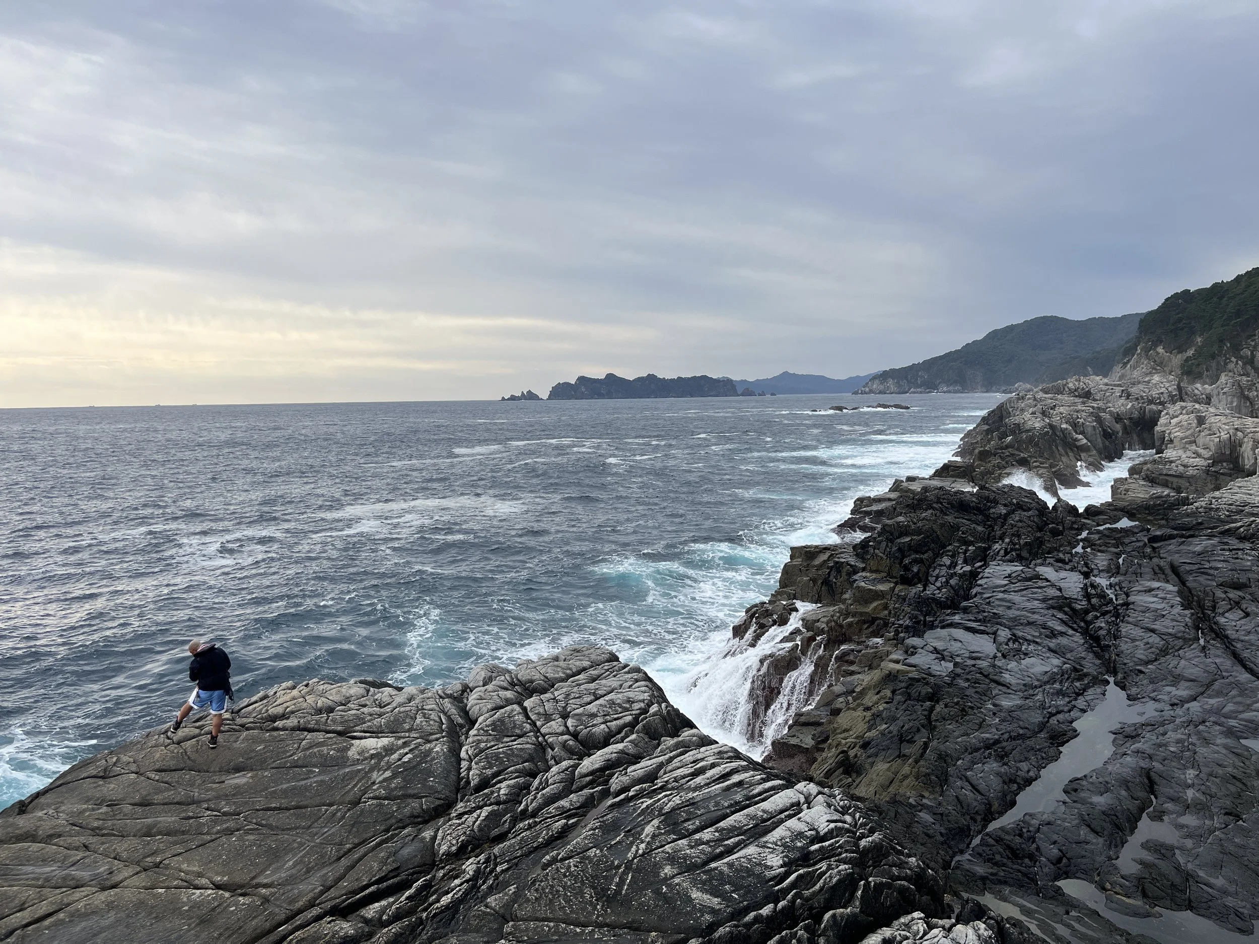
One of the wilder sections around Kamaishi, with remote coastal walking, a memorable overnight option at Ohakozaki no Yado and the option of a substantial side trip to the Senjojiki rock platform.
The peninsula takes more planning than the shorter hikes above, particularly around food, accommodation and the Senjojiki side trip, but it's a rewarding part of the trail if you want something more remote.
Detailed Hakozaki Peninsula guide coming soon.
3–7 Day MCT Itineraries
If you have more than a weekend, I don't think you necessarily need to choose one continuous section and walk every kilometre. Parts of the northern MCT are well enough connected by rail to link particularly strong sections together. That means you can spend more of your limited time actually hiking the places you came to see. These are the shorter multi-day itineraries I'd recommend.

Cliffs, Tunnels & the Pure Land
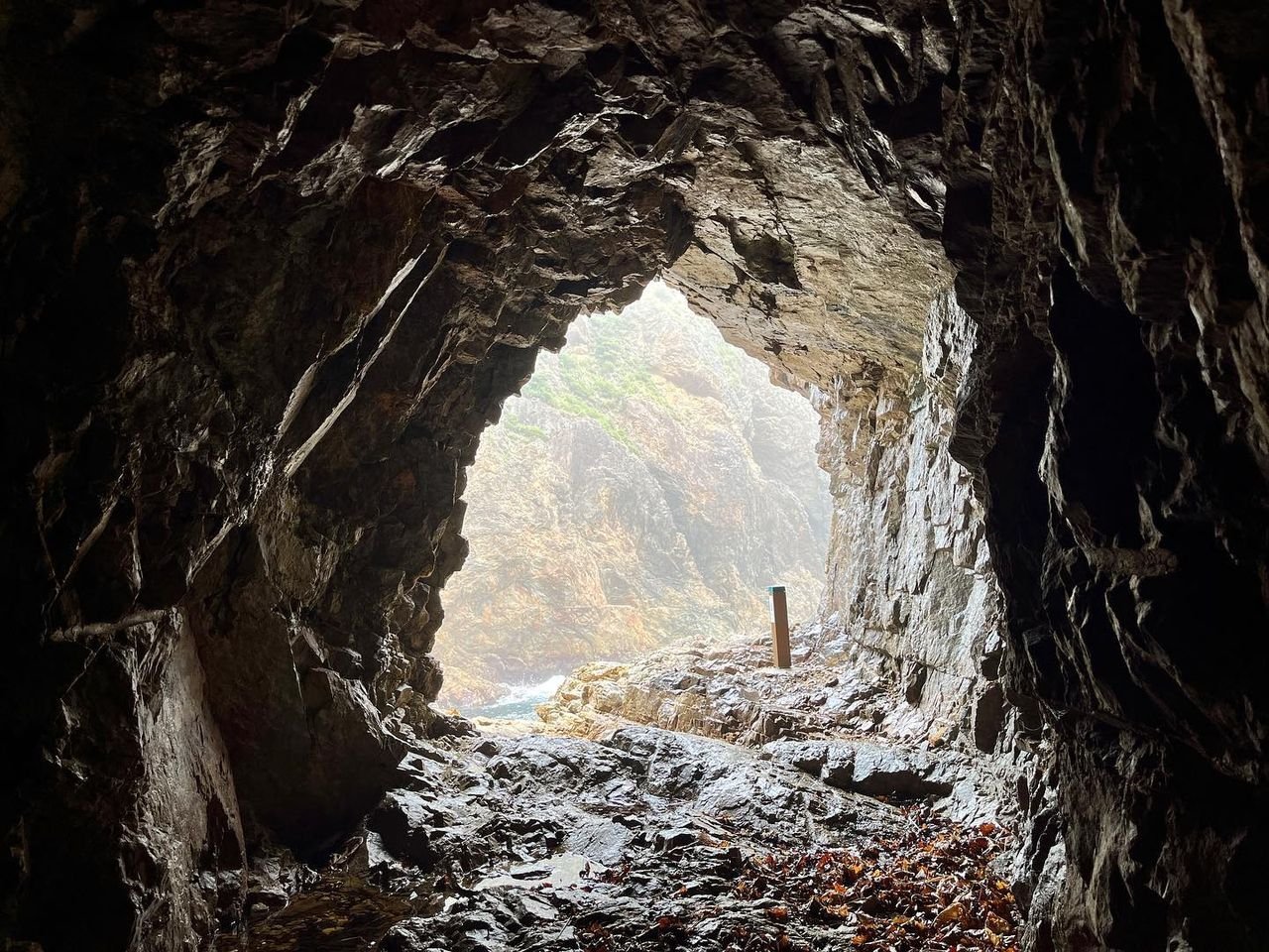
If you only have a long weekend, this would probably be my first choice. Starting in Fudai, it combines the Sea Alps, Kitayamazaki and the hand-dug tunnels with Taro's tsunami history and a finish at Jodogahama.
3-day highlights version
| Day | Route | Walking | Overnight | Logistics |
|---|---|---|---|---|
| Day 1 |
Fudai → Kurosaki-so Detailed Fudai–Tanohata Guide → |
7 km / ~2 hr 35 min | Kurosaki-so | A relatively short first hiking day. Finish with the ocean-view onsen at Kurosaki-so. |
| Day 2 |
Kitayamazaki → hand-dug tunnels → Tanohata Detailed Fudai–Tanohata Guide → |
10.2 km / ~5 hr 20 min | Tanohata | Pre-arrange a short transfer from Kurosaki-so to Kitayamazaki before starting the hike. |
| Day 3 |
Taro → Anegasaki transfer → Shiofuki-ana → Jodogahama Detailed Taro–Jodogahama Guide → |
8.2 km / ~4 hr 15 min from Anegasaki | Jodogahama / Miyako or onward | Take the train to Taro, spend some time there, then shorten the walking day with a transfer towards Anegasaki. |
Make it a 4-day, mostly-walking trip
Instead of transferring from Kurosaki-so to Kitayamazaki, walk the full
Kurosaki-so → Kitayamazaki → Tanohata section:
19.3 km / about 8 hr 50 min.
It is entirely walkable, but expect a long and demanding day with repeated
climbs and descents.
See Detailed Route Guide →
Then split the full Taro → Jodogahama route over two days:
walk Taro → Anegasaki on Day 3 and
Anegasaki → Shiofuki-ana → Jodogahama on Day 4.
See Detailed Route Guide →
The Sea Alps to Jodogahama
This version skips the gentler Tanesashi opening and starts further south, putting more of your five days into rugged northern Sanriku hiking. Fudai, Kitayamazaki and the hand-dug tunnels remain at the heart of the trip.
| Day | Route | Walking | Overnight | Logistics |
|---|---|---|---|---|
| Day 1 | Arrive Hachinohe | — | Hachinohe | Travel and preparation day. |
| Day 2 |
Train to Rikuchu-Nakano → Moguranpia Related Kuji / Taneichi Guide → |
~15.6 km / ~7 hr | Kuji | From Moguranpia, either take a taxi to Kuji or walk roughly 50 minutes to Rikunaka-Natsui Station and take the JR Hachinohe Line. |
| Day 3 |
Train Kuji → Fudai, then
Fudai → Kurosaki-so Detailed Fudai–Tanohata Guide → |
7 km / ~2 hr 35 min | Kurosaki-so | Public transport followed by a relatively short hiking day. |
| Day 4 |
Transfer to
Kitayamazaki → hand-dug tunnels → Tanohata Detailed Fudai–Tanohata Guide → |
10.2 km / ~5 hr 20 min | Tanohata | Pre-arrange a short transfer from Kurosaki-so to Kitayamazaki. Strong hikers can instead walk the entire route from Kurosaki-so. |
| Day 5 |
Train to Taro → Jodogahama Detailed Taro–Jodogahama Guide → |
8.2–22.5 km depending on option | Miyako / onward | Transfer towards Anegasaki for the shorter version, or walk the full route from Taro. |
Possible, but significantly harder
Day 2: Walk from Moguranpia to Rikunaka-Natsui Station and take the train into Kuji rather than using a taxi.
Day 4: Walk the full
Kurosaki-so → Kitayamazaki → tunnels → Tanohata route:
19.3 km / about 8 hr 50 min.
See Detailed Route Guide →
Day 5: Walk the complete
Taro → Jodogahama route, approximately
22.5 km.
See Detailed Route Guide →
This makes Days 4 and 5 two substantial hiking days back-to-back, so I'd only recommend the fully walking-based version to experienced, reasonably fast hikers.
Best of Northern Sanriku
If someone told me they had a week and wanted a broad introduction to the MCT, this is the trip I'd suggest. It combines the gentler northern trailhead and Tanesashi Coast with wilder coastline further south, then finishes with Fudai, Kitayamazaki, the tunnels, Taro and Jodogahama. It is not a continuous thruhike: regular trains are used to link particularly strong sections.
| Day | Route | Walking | Overnight | Logistics |
|---|---|---|---|---|
| Day 1 | Arrive Hachinohe | — | Hachinohe | Travel and preparation day. |
| Day 2 |
Kabushima → Tanesashi Coast Detailed Tanesashi Coast Guide → |
~8 km / allow ~3.5–4 hr with stops | Tanesashi | A gentle introduction to the trail with easy rail access. |
| Day 3 |
Train to Rikuchu-Nakano → Moguranpia Related Kuji / Taneichi Guide → |
~15.6 km / ~7 hr | Kuji | After the hike, walk roughly 50 minutes to Rikunaka-Natsui Station and take the train to Kuji. A taxi is the easier alternative. |
| Day 4 |
Train Kuji → Fudai, then
Fudai → Kurosaki-so Detailed Fudai–Tanohata Guide → |
7 km / ~2 hr 35 min | Kurosaki-so | Easy rail connection followed by a shorter hiking day. |
| Day 5 |
Kurosaki-so → Kitayamazaki → tunnels → Tanohata Detailed Fudai–Tanohata Guide → |
19.3 km / ~8 hr 50 min | Tanohata | A long and demanding day. Start early. An optional transfer to Kitayamazaki makes this substantially easier. |
| Day 6 |
Train to Taro → Anegasaki Detailed Taro–Jodogahama Guide → |
Roughly 14 km | Anegasaki | Walk the first part of the Taro–Jodogahama route and split the journey naturally at Anegasaki. |
| Day 7 |
Anegasaki → Shiofuki-ana → Jodogahama Detailed Taro–Jodogahama Guide → |
8.2 km / ~4 hr 15 min | Miyako / onward | Finish at Jodogahama, then continue into Miyako by bus if needed. |
Shorten the toughest day
Day 5 is the hardest day of this itinerary: Kurosaki-so → Tanohata is 19.3 km / about 8 hr 50 min through repeated coastal climbs and descents.
If that is more than you want to take on, arrange a short transfer from
Kurosaki-so to Kitayamazaki and walk
Kitayamazaki → tunnels → Tanohata instead:
10.2 km / about 5 hr 20 min.
See Detailed Route Guide →
On Day 3, you can also take a taxi from Moguranpia to Kuji rather than adding the walk to Rikunaka-Natsui Station.
Walking the Full Michinoku Coastal Trail
Walking the whole MCT is a different undertaking. The trail is divided into 10 official Hiking Map Book sections, each covering roughly 90–140 km. Using those same boundaries makes it much easier to plan alongside the official maps and Data Book.
| Section | Route | Distance |
|---|---|---|
| 1 | Kabushima, Hachinohe → Kuji | 100 km |
| 2 | Kuji → Settai | 102 km |
| 3 | Settai → Rikuchu-Yamada | 121 km |
| 4 | Rikuchu-Yamada → Kamaishi | 130 km |
| 5 | Kamaishi → Rikuzentakata | 139 km |
| 6 | Rikuzentakata → Motoyoshi | 109 km |
| 7 | Motoyoshi → Onagawa | 125 km |
| 8 | Onagawa → Ishinomaki | 94 km |
| 9 | Ishinomaki → Natori Trail Center | 88 km |
| 10 | Natori Trail Center → Matsukawaura | 104 km |
Northbound or Southbound?
Official materials number the trail from north to south, starting at Hachinohe and finishing at Soma. I have also walked it the other way, northbound from Soma to Hachinohe, and I'd personally do the same again. There are good arguments for both directions, though, and season matters!
A Note on Routes & Current Conditions
The MCT changes. Storm damage, landslides, construction, ferry schedules and other local conditions can affect the route, sometimes significantly.
Use the route guides on this site for planning and first-hand context, but always check the latest official MCT maps, GPX data and trail alerts before setting out.
MAPS & NAVIGATION →