How Difficult Is the Michinoku Coastal Trail?

The short answer: it really depends where you walk. The Michinoku Coastal Trail isn't technically difficult in the mountaineering sense. Most of it is walking, not climbing, and you don't need specialist skills to enjoy it. But don't mistake that for saying the whole trail is easy. Some sections are genuinely gentle. Others involve hours of steep ups and downs, endless-feeling stairs, rough forest trail and surprisingly slow progress. The biggest thing I'd tell anyone planning their first trip is this: Don't judge an MCT day by the number of kilometres.
So, how hard is it?
Most of the MCT is hiking rather than climbing. You don't normally need specialist skills.
Repeated elevation, stairs, rough trail and long days can make some sections properly tiring.
A gentle walk along the Tanesashi Coast and a full day in northern Iwate can feel like completely different trails.
You don't need to be an expert hiker. You just need to pick the right section for you.
Don't Judge It By Kilometres
This is probably the most important thing; a flat 20 km road day and a 20 km day through northern Sanriku are not the same thing. Around Fudai and Kitayamazaki, for example, the trail repeatedly drops from the coastal terrace into small valleys and streams before climbing all the way back up again. There's no enormous mountain involved.
It's more like: DOWN → UP → DOWN → UP → DOWN → UP for quite a long time.
That's why a section that looks short on the map can still take most of the day. When planning, make sure to consider: DISTANCE + ELEVATION + TERRAIN + EXPECTED TIME
What Actually Makes the MCT Hard?
The Surface: This isn't 1,000 km of mountain trail. Far from it. A useful rule of thumb is that roughly 70% of the MCT is paved. But that figure can be a little misleading. MCTA staff sometimes estimate that the unpaved 30% accounts for something closer to half of your actual walking time, simply because those sections are generally much slower. I wouldn't treat that as an exact statistic. The useful point is that 30% of the distance doesn't necessarily mean 30% of the effort. There are long stretches of paved road and path. There are also forest trails, old mountain passes, grass, beaches, roots, rocks and rougher coastal sections. Road walking is usually faster, but don't assume that means effortless. Several long days on pavement can be surprisingly hard on your feet. Natural trail slows you down. Wet natural trail slows you down even more. One reason I like the MCT so much is that it keeps changing. You rarely spend very long walking exactly the same kind of trail.
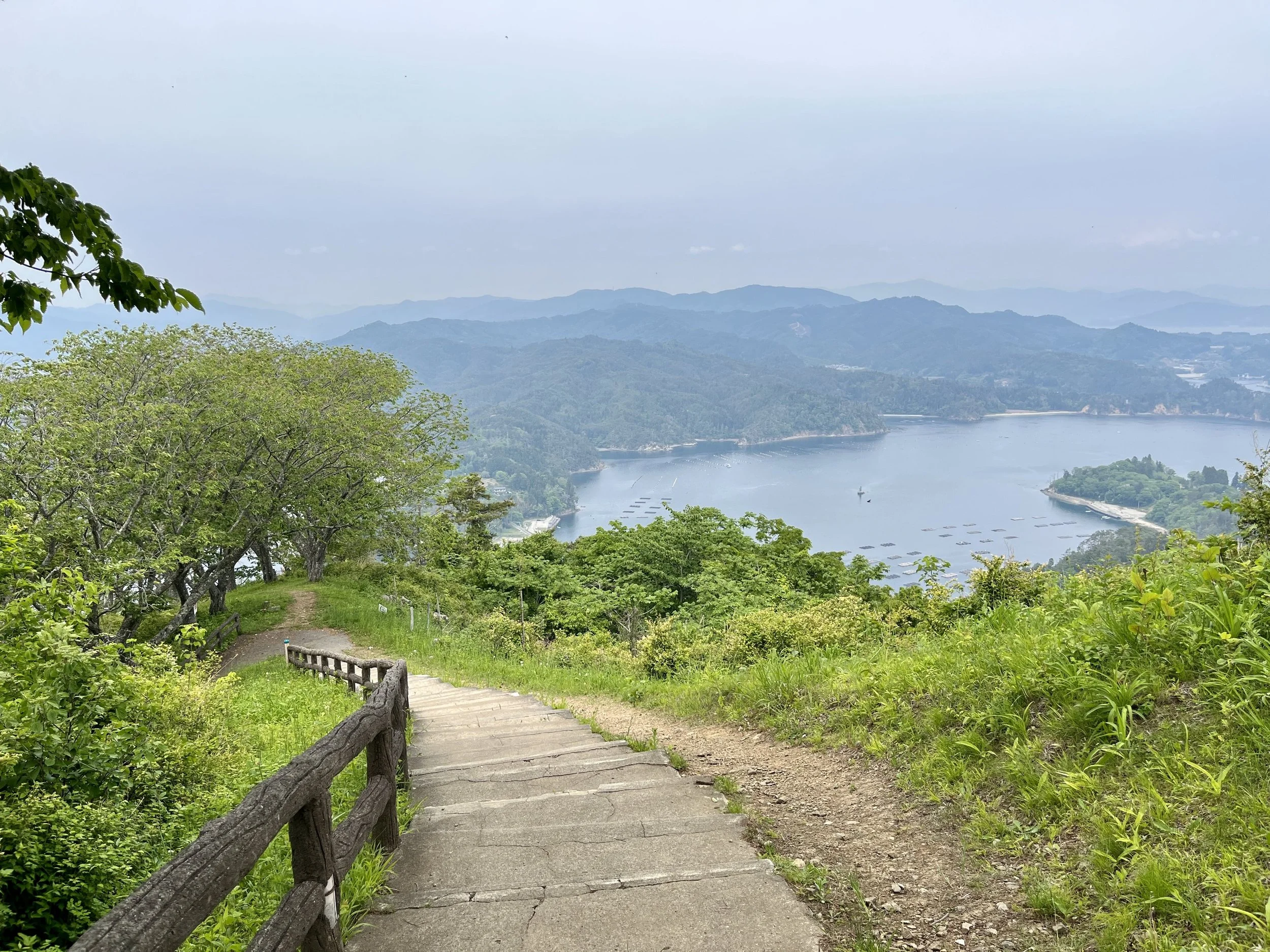
Ups and downs: There are mountains on the MCT, but huge summit climbs aren't really what make the trail difficult. What catches people out is how often you climb. This is especially true along the rias coastline and the coastal terraces of Iwate. The trail drops toward fishing villages, beaches and streams, then climbs back onto the ridge or terrace above. Then it does it again. And again. One big climb can actually be easier to plan around. The MCT often gives you ten smaller ones instead.
Stairs: If you've already looked at photos of the MCT, you've probably spotted them. Stairs are a very normal part of some of the more rugged sections, especially in northern Iwate. Some are long wooden staircases. Others are basically steps cut into steep forest terrain. None of this is technically complicated. But after a few hours of climbing and descending, you definitely notice them. And going down can be just as tiring as going up.
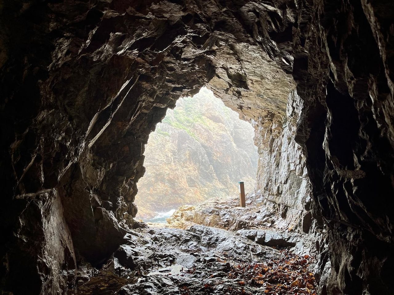
Tunnels (they’re lovely): South of Kitayamazaki, the MCT passes through a series of old hand-dug tunnels. They're one of my favourite bits of the whole trail. They're also completely dark. Bring a decent headlamp. The tunnels themselves aren't technically difficult or very long, but the ground can be wet and uneven, and there are also a handful of ladders through this stretch. Again, nothing that requires climbing experience. This is also one of the highlights of the trail - well worth it! SEE FUDAI → TANOHATA →
What Does the Trail Actually Look Like?
There isn't really one typical MCT surface.
Fast, straightforward walking. Surprisingly hard on your feet over multiple days.
Roots, rocks, leaves and uneven ground. This is normally where your pace drops.
The classic northern Sanriku experience. Small valleys and bays create much more elevation than the word "coastal" suggests.
Lots in some sections. Your knees will become aware of them.
Usually short. Occasionally awkward. Often beautiful.
Mostly concentrated around northern Iwate. Bring a headlamp.
The MCT Isn't One Difficulty
The easiest way to explain this is with a few actual sections.
Tanesashi Coast
- Relatively flat and easy to follow
- Beaches, grassy coastline, pine forest and great sea views
- I've walked it with my mum and some of my closest friends, which probably tells you more than any difficulty rating could
Good for: First-time MCT hikers, day hikers and mixed groups
SEE TANESASHI COAST →Fudai → Tanohata
- Big cliffs, forest, Kitayamazaki and the hand-dug tunnels
- Lots of repeated climbing and descending
- One of the tougher short trips on the MCT, and also one of the best
If you want to understand why I keep saying not to judge the trail by kilometres, walk this section.
Good for: Fit, experienced walkers looking for some of the MCT's most dramatic terrain
SEE FUDAI → TANOHATA →Taro → Jodogahama
- Natural trail, forest and cliff coastline
- Plenty of ups and downs, but not quite as relentless as the Sea Alps further north
- You finish at the beautiful Jodogahama
Good for: Hikers wanting a proper MCT day without jumping straight into the hardest terrain
SEE TARO → JODOGAHAMA →Omoe Peninsula
- Climbs, forest trail and some long stretches on foot
- Shops, accommodation and public transport are much more limited
- Fewer easy options if you decide you want to shorten the day
Somewhere you need to have thought things through before setting off.
Good for: Experienced hikers comfortable with longer, less flexible days
And further south?
Large parts of Miyagi and Fukushima are flatter and more road-heavy than northern Sanriku.
- You'll often cover ground more quickly
- There are still mountain and natural-trail sections mixed in
- Long days on pavement can be tough in a completely different way
Your feet don't care that the elevation profile looks easy.
EXPLORE ALL ROUTES →How Fit Do I Need to Be?
It depends much more on which part of the trail you're walking than on being especially fit.
- Comfortable walking for a few hours? There are plenty of options. Tanesashi Coast is a great place to start.
- Carry a light pack, take your time and enjoy it.
You definitely don't need to be a long-distance hiker.
The question changes from: Can I walk 20 km? to: Can I walk 20 km today and do something similar tomorrow?
- Harder northern sections can mean most of a day on your feet.
- Expect repeated climbing and descending on uneven trail.
- Go slow, enjoy the view and repeat!
The full MCT is mainly an endurance and planning challenge.
- Hard days add up - take ample rest days and buffer for bad weather.
- Pavement adds up.
- A heavier pack adds up.
- You're also planning food, accommodation, weather and transport as you go.
You don't need to be an elite athlete, but you do need to pace yourself and plan well to maximise enjoyment!
What Else Changes the Difficulty?
PACK WEIGHT: A daypack and a full camping pack make the same trail feel very different. A heavier pack is especially noticeable on stairs, descents and rougher trail. Staying indoors and travelling light can make a lot of the MCT considerably easier. PACKING → · CAMPING →
WEATHER: Conditions can completely change the same section.
Rain makes roots, rocks and descents slower.
Summer heat can turn an easy day into a real sweaty mess!
Wind matters on exposed sections, and snow/ice can affect higher or shaded areas in winter.
Check the route + the weather. WHEN TO GO →
LOGISTICS: Sometimes the walking isn't the hardest part. Your day might be determined by:
where the next bed is
the last train or bus
the only shop, etc.
A manageable hike can become a much longer day if your accommodation is another 8 km down the road.
ACCOMMODATION → · GETTING AROUND → · FOOD & WATER →
Is It Hard to Navigate?
Usually, no. But I do not try to walk the MCT by following signs alone! Some sections are obvious, but others have small road-to-trail transitions, forest junctions and turns that are surprisingly easy to miss, as well as sparse signage. I use the official route information together with paper/offline maps and GPX data, and I'd download everything before setting off. Mobile signal isn't reliable everywhere. You don't need advanced navigation skills. Just don't assume the next sign will always appear exactly when you want one.
How To Judge an MCT Day
Before deciding whether a section is realistic, I normally look at distance, elevation, walking time, terrain, food and water, accommodation, transport and current conditions together.
How far am I actually walking?
One big climb, or dozens of smaller ones?
Often more useful than the distance.
Road? Forest? Stairs? Beach? A mixture?
Can I resupply, or am I carrying everything?
Can I stop where I want, or do I have to reach a particular place?
Can I shorten the day if I need to?
Rain? Heat? Snow? Wind? Recent trail damage?
Look at all eight and you'll have a much better idea of how hard the day will actually feel than you ever will from the kilometre number alone!
Pick the MCT That Fits You
You don't have to walk the hardest sections, cover 30 km a day, or hike all 1,000+ km. Walk Tanesashi Coast for a day. Spend a couple of days around Kitayamazaki. Link a few favourite sections by train. Or start at one end and keep going. There's no single right way to walk the MCT; pick the version that sounds good to you!