The Hachinohe-Towada Trail: A New 120km Trail Connecting to the Michinoku Coastal Trail
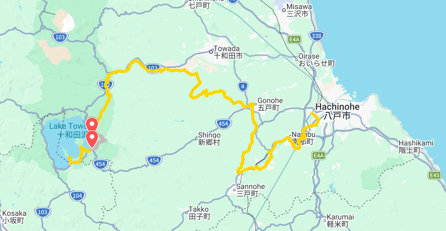
There’s another reason to go hiking in Tohoku! The new Hachinohe-Towada Trail (HTT), known as the 八戸十和田トレイル, stretches approximately 120 kilometres across Aomori Prefecture, linking Hachinohe with beautiful Lake Towada. Even more exciting for Michinoku Coastal Trail hikers: it connects with the northern end of the MCT, opening up the possibility of an even longer journey through northern Japan.
From Hachinohe to Lake Towada
Starting at Hachinohe Station, the trail passes through Nanbu, Gonohe and Towada before finishing at Towada Shrine on the shores of Lake Towada.
Rather than following one type of landscape, the route gradually changes as you walk. It leads from the Hachinohe area through farmland and orchards, rural communities, forests and mountain streams before reaching the spectacular surroundings of Oirase and Lake Towada.
That makes the HTT quite different from the predominantly coastal landscapes of the Michinoku Coastal Trail.
Three Trails. More Than 1,300 Kilometres
This is the part I find particularly exciting. To the north of the 1,000+ km Michinoku Coastal Trail is now the Hachinohe-Towada Trail. At the southern end of the MCT, hikers can continue onto the approximately 200 km Fukushima Coastal Trail.
Together, the Hachinohe-Towada Trail, Michinoku Coastal Trail and Fukushima Coastal Trail form a walking journey of more than 1,300 kilometres through Tohoku.
So, theoretically, you could start beside Lake Towada in Aomori, walk east towards Hachinohe, continue down the Pacific coast on the Michinoku Coastal Trail, and then keep walking through Fukushima.
If 1,000 kilometres of hiking wasn't quite enough for you, Tohoku has you covered.
Planning the Hachinohe-Towada Trail
One thing to be aware of is that the HTT is still developing.
The trail has been trial-open since April 2025, while work continues on signage, route improvements and other infrastructure ahead of a planned full opening in FY2027. The official website also notes that accommodation, buses and access can be limited in some areas, so hikers should plan carefully rather than expect MCT-level infrastructure everywhere.
I haven't walked the Hachinohe-Towada Trail myself yet, so for now I'd recommend using the official website for the latest route maps, access information and trail conditions.
👉 Official Hachinohe-Towada Trail website:
httrail.org
And if you're planning to continue south from Hachinohe, you can find everything you need to start planning the Michinoku Coastal Trail here on MichinokuTrail.com.